
Cotabato City
Mindanao
Cotabato City’s extensive riverine networks provide transport routes, food, and leisure to its people. However, due to the location of the city below sea level and at the tailend of the Mindanao River Basin, occasional inundation from tidal intrusions and sedimentation makes the city highly vulnerable to flash floods. This is aggravated by the obstruction of garbage and water lilies in Bagua Creek, an important exit channel not only for the big rivers surrounding the city but also for surface runoff.
-
Cotabato City seeks to revitalize the Bagua Creek to its former status as a thoroughfare for water transportation and vibrant waterway in the city. Currently, due to silt, mostly coming from the Rio Grande de Mindanao River, and the presence of settlements along and within the creek, it is not navigable. Flooding along the creek is also a chronic issue as rainwater is unable to effectively flow along the creek.
Because of its historical value and potential for socio-economic activities, it carries the potential as an ecotourism site of the city.
The deforestation from upstream areas makes the eroded soil from mountains and hills easily transportable to the water bodies of the city. This contributes to the reduced depth of Cotabato’s riverbeds, reduced river widths, and accretions.
-
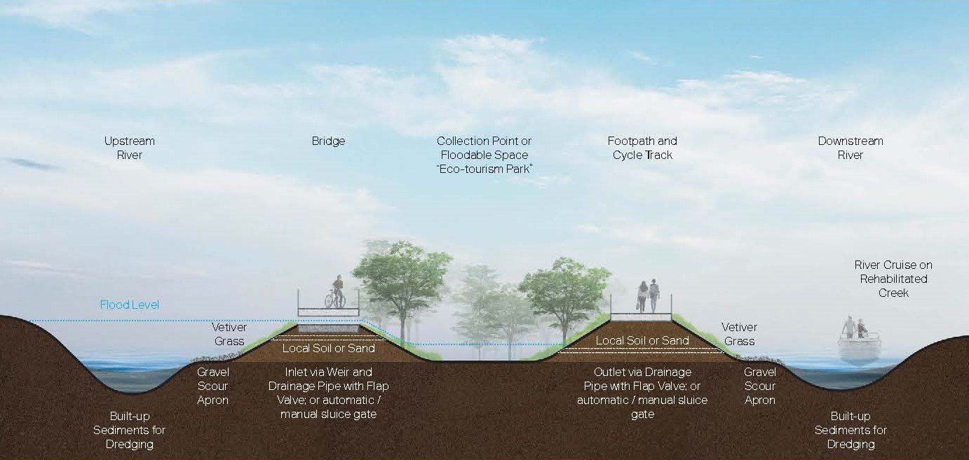
The project site is a 4,300-kilometer stretch that branches out from Rio Grande de Mindanao starting from the Teksing area ending up at Pamang Creek. It crosses the Tanghal Bridge, Manday Bridge, Mahad Bridge and other small crossovers.
The proposed project shall consist of:
a) the just and safe relocation of informal settler families from the waterway’s no-build buffer;
b) the dredging of the silted creek to increase the depth by least 2.5 meters to ensure waterflow; and
c) developing open spaces along the river into floodable basins/parks to reduce the flooding within the surrounding barangays and increase public park space.
The sediments collected from the dredging can be used for the waterway embankment. Four potential sites along Bagua Creek for the floodable basins/parks have been put forward by the city, but these are still subject to negotiation and further study. Meanwhile, the upstream edges of the river may be enhanced by riparian buffers to intercept farmland runoffs.
-
Rehabilitating Bagua River through green-gray infrastructure in Cotabato City may unlock multiple benefits including:
• Improve waterflow along the Bagua River and connected waterways
• Reduce the impact of flooding on the urban barangays
• Creation of areas for biodiversity to flourish
• Reduce the incidence of water and sanitation related diseases
• Boost tourism industry and tourism-related jobs
Ultimately, the pilot can make a case for the city wide adoption of nature-based strategies to:
• Make the city inclusive, safe, resilient and sustainable
• Conserve Cotabato’s river network and riverine ecosystems
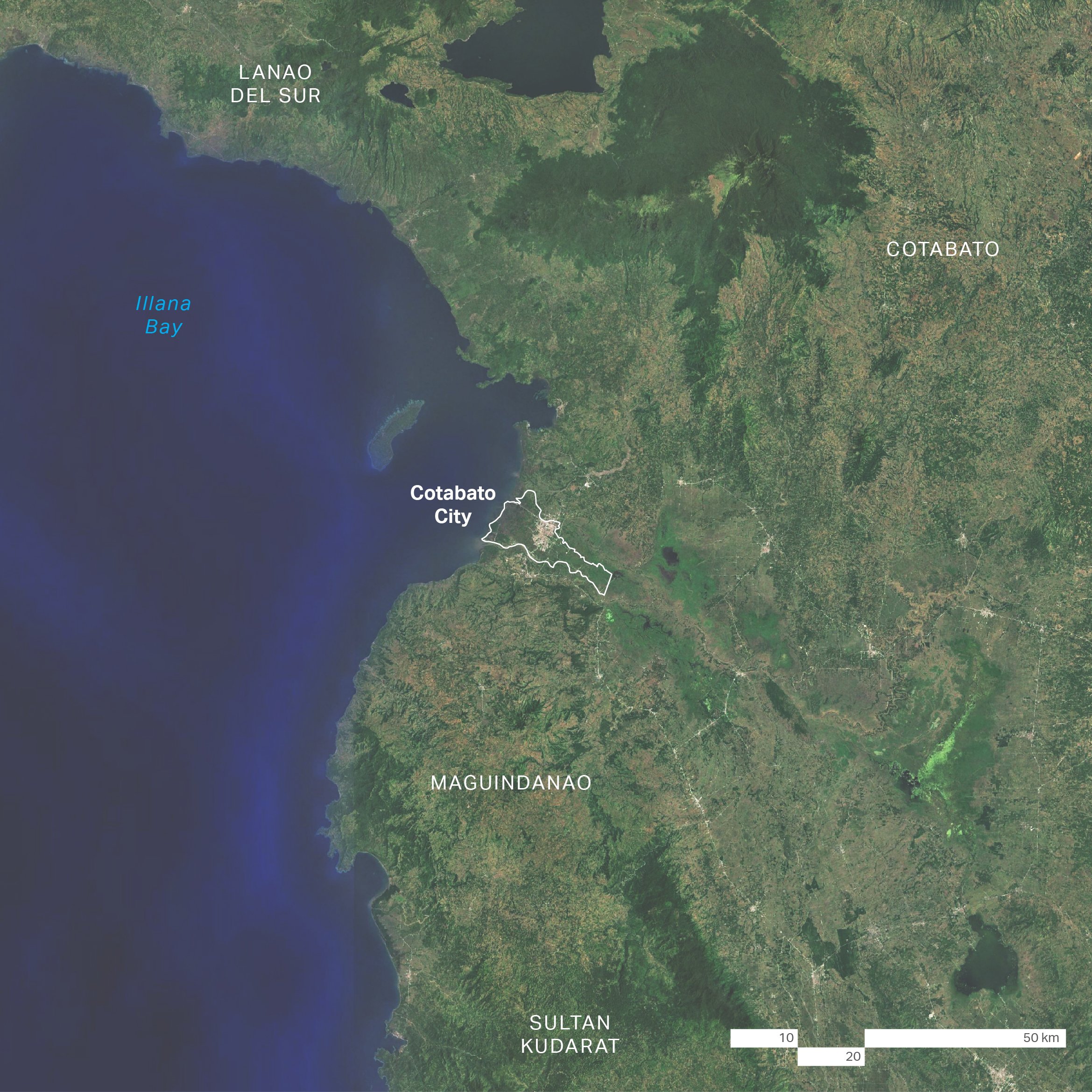
Location Map 1
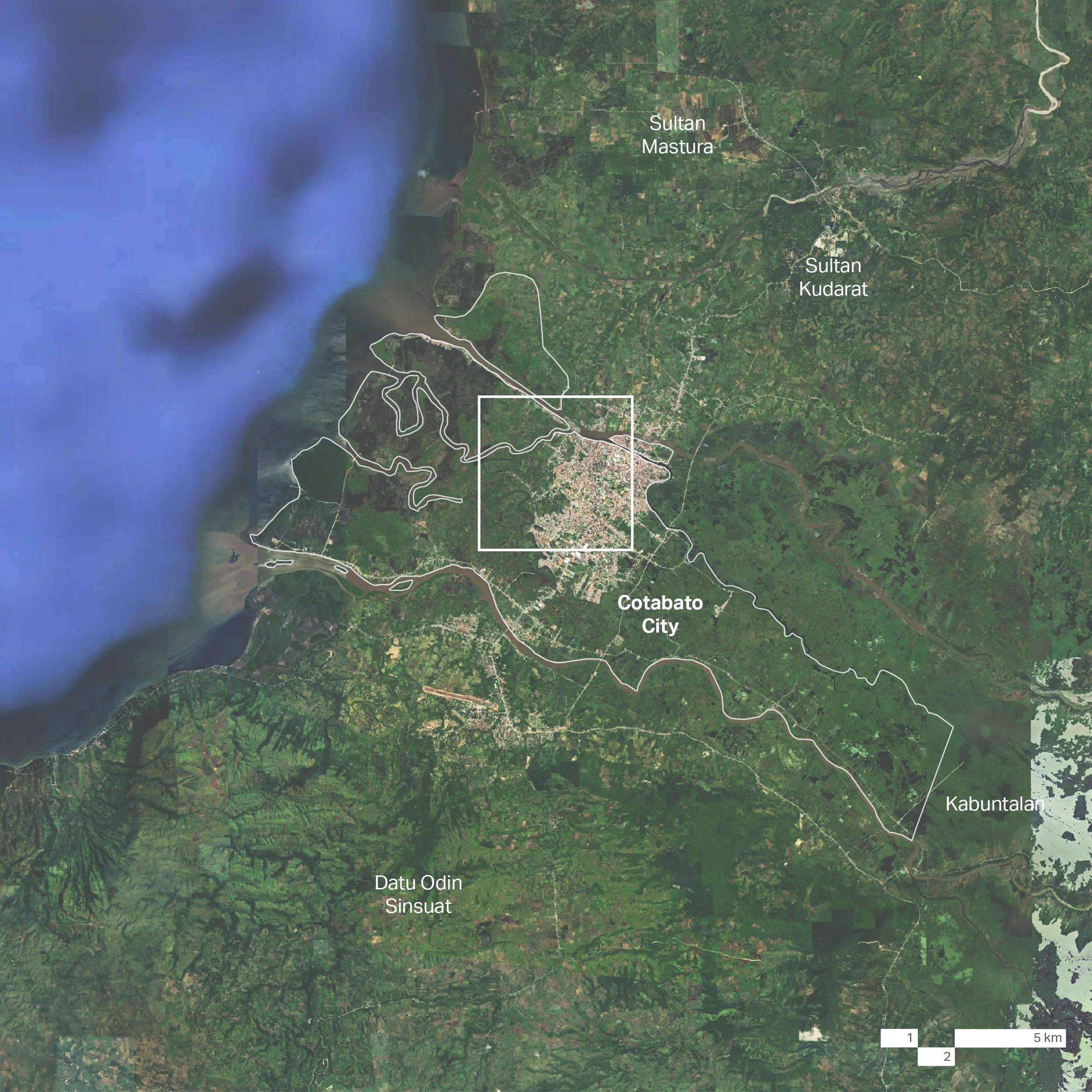
Location Map2

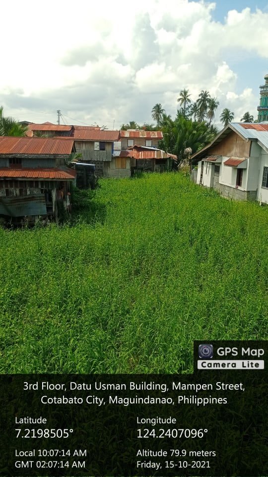
Built-up sediments and waste on Bagua Creek
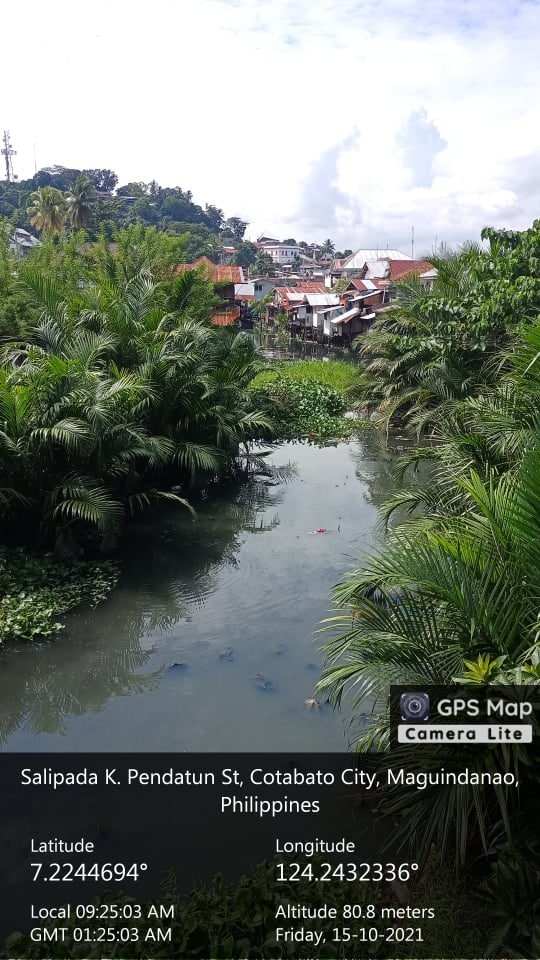
Encroaching settlements on Bagua Creek easement
Encroaching settlements on Bagua Creek easement

Concept Strategy Plan

Concept Strategy Blow-up Plan

Concept Strategy Section: Creek Rehabilitation
Concept Strategy Section: Floodable Space